Use ArcGIS Server web services in ArcMap or ArcGIS Pro
ArcGIS REST Services (ArcGIS Server) allow you to load GIS data directly from the County's servers into an ArcMap / ArcGIS Pro session on your computer. This means the data will always be up-to-date; no need to re-download a shapefile. You'll be using the same data that Henderson County staff are using.
Instructions
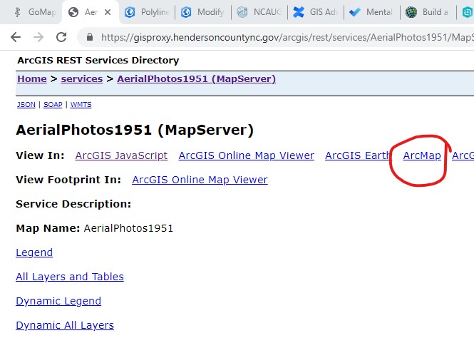
- Go to https://gisproxy.hendersoncountync.gov/arcgis/rest/services
- Navigate to a layer you'd like to add to your ArcMap/ArcGIS Pro project.
- Click the "ArcMap" link (see image below) - this will download a "LYR" file to your computer.
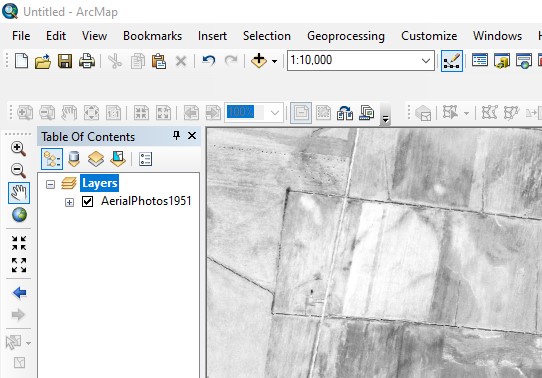
- Drag the LYR file directly into ArcMap or ArcGIS Pro.