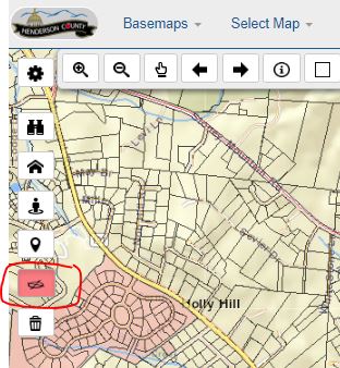
How do I use the Oblique Aerial View?
- Navigate to an area of interest.
- Click the Oblique Aerial View tool so that it is highlighted red.
- Click a location on the map to see oblique aerial images for that area. This opens the 'Pictometry View' window.
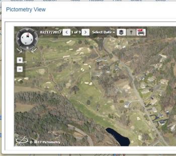
- Once in Pictometry View, use these tools to navigate the system:
- On the directional circle in the upper-left, click the arrows to change the compass angle of the image.
- Click the dot below the directional circle to change to vertical view. (i.e. directly above)
- Click 'Select Date' to change to a different photography year.
- Next to the photography date, click the right and left arrows to switch among the different images available for that particular angle.
- Click the layer list to add streets or contour lines to the Pictometry View.