GIS Services
GoMaps is our online mapping and GIS and is the most frequently-used service we provide. The GIS division also provides software, training, data maintenance, application development, and technical support to the county departments and various GIS services to the general public. Henderson County GIS is a division of the Information Technology Department.
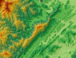
Henderson County's online GIS / mapping system. Answer property-related questions, and create printable, downloadable, or email-able maps of property, aerial photos, and other geographic information.
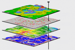
Download shapefiles, connect to ArcGIS Server services, find documentation for County GIS data, and read metadata.

Look up recorded documents such as deeds, plats, land transfers, and easements.